Methodist Episcopal Church, South, of Premont
Historical marker location: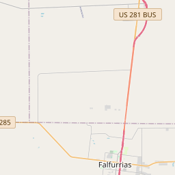


Development of Premont began in 1904; the post office opened on January 13, 1909. Visiting ministers occasionally held church services in a surveyors' and land agents' bunkhouse. About 1910, Methodists erected the town's first church, a 30' x 60' stucco chapel, sharing it with other faiths. Sometimes open also to secular gatherings, that building was used in 1943-44 by the public school system. In 1954 an educational annex was built and in 1956 the old church was razed and present sanctuary erected on the original site
As one of the most visible programs of the Texas Historical Commission (THC), historical markers commemorate diverse topics in Texas history, including: the history and architecture of houses, commercial and public buildings, religious congregations, and military sites; events that changed the course of local and state history; and individuals who have made lasting contributions to the state, community organizations, and businesses.
The Battle of San Jacinto fought on April 21, 1836, was the decisive battle of the Texas Revolution, and led to the capture of Santa Anna and the end of the conflict.
In the mid-19th century, settlers began to move into the region, attracted by its fertile soil and proximity to water sources. Agriculture, particularly cotton farming, became the main industry in the area, and the county quickly grew as a result. The railroad arrived in the late 19th century, further boosting the local economy and facilitating transportation.
The county experienced a significant population increase in the early 20th century due to the discovery of oil nearby. Oil production became a major industry, attracting businesses and workers to the area. This led to the development of towns and infrastructure, contributing to the economic growth of Jim Wells County.
Over the years, Jim Wells County has faced challenges such as droughts, floods, and economic downturns, particularly in the agriculture and oil industries. However, the county has remained resilient and has diversified its economy to include other sectors such as healthcare, education, and retail. Today, Jim Wells County continues to be an important agricultural and industrial hub in South Texas, with a rich history and a promising future.
Jim Wells County Timeline
This timeline provides a concise overview of the key events in the history of Jim Wells County, Texas.
- 1848: Jim Wells County is formed from parts of Nueces County and named after James B. Wells, a prominent political figure in the area.
- 1904: The St. Louis, Brownsville and Mexico Railway is built through Jim Wells County, leading to increased agricultural development and population growth.
- 1911: Alice becomes the county seat of Jim Wells County, replacing Orange Grove.
- 1920s-1930s: The discovery of oil and gas in the county leads to an oil boom, spurring economic growth.
- 1940s-1950s: Jim Wells County sees a decline in population and agricultural activity due to the effects of World War II and changes in farming practices.
- 1988: Hurricane Gilbert hits Jim Wells County, causing significant damage and loss of life.
- 1990s-present: Jim Wells County continues to be primarily agricultural, with a focus on farming and ranching.