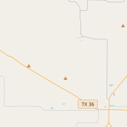
Fort Mason-Camp Cooper Military Road
Historical marker location:


Route for U.S. 2nd Cavalry and supplies from San Antonio to Fort Mason (about 100 miles south of here) to Camp Cooper (about 65 miles north) in campaigns of 1851-1861 against Plains Indians. Great military men of American history traveled this road, including Robert E. Lee (later a commanding general, C.S.A.) and George T. Thomas, "Rock of Chickamauga."
Callahan County Historical Survey Committee, 1967
As one of the most visible programs of the Texas Historical Commission (THC), historical markers commemorate diverse topics in Texas history, including: the history and architecture of houses, commercial and public buildings, religious congregations, and military sites; events that changed the course of local and state history; and individuals who have made lasting contributions to the state, community organizations, and businesses.
The world's first rodeo was held in Pecos, Texas in 1883. The event included bronco riding, calf roping, and bull riding.
In 1858, the Texas Legislature officially established Callahan County, naming it after James Hughes Callahan, a ranger and soldier in the Texas Revolution. The county's early economy relied heavily on agriculture, with cotton being the main cash crop and cattle ranching also playing a significant role.
During the Civil War, like many regions of Texas, Callahan County experienced unrest and hardship. After the war, however, the county quickly recovered, and the construction of the Texas and Pacific Railway in the late 19th century further fueled growth and development. The railroad brought new settlers, boosted trade, and led to the establishment of towns like Baird, Cross Plains, and Clyde.
Throughout the 20th century, Callahan County continued to evolve and diversify its economy. Oil was discovered in the area in the 1920s, leading to the establishment of oilfields and the growth of the petroleum industry. Agriculture remained important, with crops like wheat, milo, and sorghum becoming significant, and ranching continued to thrive.
Today, Callahan County is a vibrant community that honors its history while embracing modern advancements. Its rich agricultural heritage, coupled with a growing oil and gas industry, makes this county a resilient and prosperous area within the state of Texas.
Callahan County Timeline
This timeline provides a condensed summary of the historical journey of Callahan County, Texas.
- 1854 - Callahan County is created and named after James Hughes Callahan, a Texas Ranger and legislator.
- Late 1850s - Settlers begin to arrive in the area, primarily from the southern United States.
- 1861-1865 - Callahan County, like the rest of Texas, is greatly impacted by the American Civil War.
- 1872 - Baird is established as the county seat.
- Early 1880s - The Texas & Pacific Railway is built through Callahan County, boosting economic growth.
- Early 1900s - Agriculture, particularly cotton farming, becomes a major industry in the county.
- 1923-1924 - Oil is discovered in Callahan County, leading to a boom in production and economic development.
- 1940s - Callahan County experiences a decline in population due to the effects of World War II.
- 1980s-1990s - The economy diversifies with the growth of manufacturing and retail sectors.
- 2000s - Callahan County continues to be primarily rural, with agriculture and oil production playing significant roles in the local economy.