First Baptist Church of Lytle
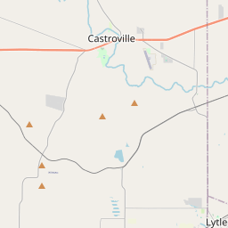
Historical marker location:


Dr. J.V.E. Covey and 16 charter members organized this church in April 1893 and held their first meeting under a stand of oak trees. A small frame building was later built, becoming their first permanent church building. Early baptisms were performed in the Medina River. Over the years the church has erected new and larger buildings to serve its growing congregation. The church has been instrumental in initiating additional congregations in Natalia, Atascosa, LaCoste, and Castroville. The church continues to be active in the community as it has for over 100 years. (1996)
As one of the most visible programs of the Texas Historical Commission (THC), historical markers commemorate diverse topics in Texas history, including: the history and architecture of houses, commercial and public buildings, religious congregations, and military sites; events that changed the course of local and state history; and individuals who have made lasting contributions to the state, community organizations, and businesses.
The state of Texas was once an independent country known as the Republic of Texas. It gained independence from Mexico in 1836 and was a separate nation until it was annexed by the United States in 1845.
In the early 19th century, the region experienced a migration of American settlers. Atascosa County, named after the Atascosa River that flows through it, was officially established in 1856. The county played a significant role in the Texas Revolution, with several battles fought in the area. The region's fertile land attracted farmers and ranchers, leading to the growth of the agricultural industry. Cattle ranching soon became a dominant economic activity, and the county became known for its large cattle drives and sprawling ranches.
During the Civil War, Atascosa County sided with the Confederacy, and the conflict brought some challenges to the area. However, after the war, the county experienced a period of growth and development. Railroads were constructed, connecting the county to larger markets, and the establishment of towns and communities brought further prosperity.
In the 20th century, Atascosa County continued to thrive economically, primarily due to agriculture, particularly cotton and corn farming. Oil and gas exploration also became significant industries in the region. The growth of cities such as Pleasanton and Jourdanton brought increased infrastructure and amenities to the area. Today, Atascosa County is an important part of the South Texas economy, contributing to agriculture, oil and gas, and tourism. Its history and heritage are celebrated through various cultural events and historical landmarks.
Atascosa County Timeline
This timeline provides a glimpse into the major events and milestones that have shaped the history of Atascosa County, Texas.
- 1856 - Atascosa County is officially established by the Texas state legislature.
- 1872 - The county's first courthouse is built in Pleasanton.
- 1881 - The San Antonio and Aransas Pass Railway is completed, bringing a significant boost to the county's economy.
- 1890 - Tornadoes cause extensive damage in the county, leading to rebuilding efforts.
- 1898 - The county's second courthouse is constructed, replacing the original one.
- 1908 - The discovery of oil in the county leads to an oil boom, bringing economic prosperity.
- 1920s - Atascosa County experiences a decline in agriculture due to the boll weevil infestation.
- 1930s - The Great Depression leads to economic hardships in the county.
- 1940s - World War II brings changes to the county, including the establishment of a military training base.
- 1960s - Construction of Interstate 37 brings improved transportation infrastructure to the county.
- 1970s - Atascosa County's population starts to grow significantly, leading to increased development.
- 1990s - The county experiences further population growth and urbanization.
- 2005 - Hurricane Emily causes widespread damage in the county.
- Present - Atascosa County continues to be a mix of rural and urban communities, with a diverse economy.