The Churchill Gate
Historical marker location:
Mexico, Missouri
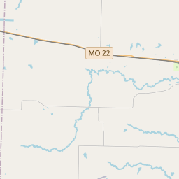
( Marker is at the intersection of Clark Street (U.S. 54) and Hendy Street, on the right when traveling north on Clark Street.)


© OpenStreetMap contributors
The Missouri Ozarks region is home to the "Bald Knobbers", a vigilante group that formed in the 1880s to enforce the law in the area. They were named after the bald hilltops where they held their meetings and were known for wearing black hoods and using violence to maintain order.
About Audrain County
Audrain County Timeline
Audrain County, Missouri, located in the heart of the United States, has a rich and diverse history that spans centuries. Originally inhabited by Native American tribes such as the Osage and the Missouri, the area was later explored by French explorers in the late 17th century. These explorers established fur trading posts, creating a foundation for future settlements.
The county was officially established on December 17, 1836, and was named after James H. Audrain, a local legislator and political figure. The early settlers of Audrain County primarily hailed from the southern states, bringing with them a strong agricultural tradition. With the fertile soil and abundance of waterways, farming quickly became the backbone of the county's economy.
During the American Civil War, Audrain County remained divided, with some residents supporting the Union and others siding with the Confederacy. The county saw its fair share of skirmishes and raids, leaving a lasting impact on the local community. In the post-war era, Audrain County experienced rapid growth and development, bolstered by the construction of railroads and the expansion of industries such as manufacturing and mining.
Today, Audrain County continues to thrive as a vibrant and close-knit community. Agriculture remains an integral part of the local economy, with soybeans, corn, and wheat being the primary crops. In addition, the county is known for its strong educational system, offering excellent schools and colleges for residents. Audrain County is also a popular destination for outdoor enthusiasts, with its abundance of parks, rivers, and lakes, providing ample opportunities for recreation and relaxation.
Audrain County Timeline
This timeline provides a glimpse into the major events and milestones that have shaped the history of Audrain County, Missouri.
- 1821 - Audrain County is officially established.
- 1836 - Mexico, MO becomes the county seat.
- Late 19th century - Railroads are constructed in the county, stimulating economic growth.
- 1907 - The city of Vandalia becomes the second county seat.
- Early 20th century - Agriculture plays a significant role in the county's economy, with soybeans and corn being major crops.
- 1926 - The Mark Twain Highway (Route 22) is established, connecting Mexico, MO to Hannibal, MO.
- 1950s - Audrain County experiences population growth due to the construction of nuclear plants in the area.
- 1965 - The Audrain County Historical Society is formed to preserve the county's rich history.
- 2009 - Audrain County celebrates its 200th anniversary.