Saint Landry Parish Mural
Historical marker location:
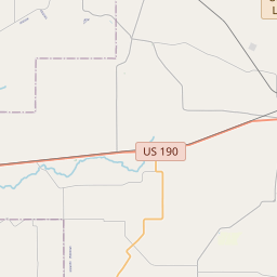
132 East St. Landry Street, Opelousas, Louisiana
( Marker is on East St. Landry Street (U.S. 190) west of South Court Street, on the right when traveling west.)


© OpenStreetMap contributors
Loading...
Searching for other points of interest within 3 miles of this location.Hurricane Katrina, which struck Louisiana in 2005, was one of the deadliest and costliest hurricanes in U.S. history. The storm caused widespread destruction in New Orleans and other parts of the state, and its aftermath highlighted issues of poverty, race, and government response in the United States.
About St. Landry Parish
St. Landry Parish Timeline
St. Landry Parish, located in southwestern Louisiana, has a rich and diverse history dating back thousands of years. The area was inhabited by Native American tribes, including the Attakapas and Opelousas, before the arrival of European settlers. In the 18th century, French Acadian refugees known as the Cajuns began to settle in the region, establishing a strong farming and agricultural community.
St. Landry Parish was officially established in 1807, and was named after the Catholic Church of St. Landry in Opelousas. The early settlers primarily engaged in subsistence farming, hunting, and trapping, and developed close ties to the land. As the region continued to grow, cotton became the dominant crop and a major force in the local economy. The plantation system brought both wealth and slavery to St. Landry Parish, shaping much of its social and cultural history.
The parish played a significant role during the Civil War, with many local residents supporting the Confederacy. The area was invaded multiple times by Union forces, leading to significant destruction and loss. However, St. Landry Parish rebounded after the war, and diversified its agricultural industry to include sugarcane, rice, and livestock. The arrival of the railroad in the late 19th century further facilitated economic growth and increased connectivity to other parts of the state.
In the 20th century, St. Landry Parish continued to evolve. The discovery of oil brought prosperity to the region, and industrialization began to reshape the local economy. The parish also witnessed the Civil Rights Movement, with significant activism and efforts towards desegregation. Today, St. Landry Parish is a vibrant and culturally rich area, known for its Cajun and Creole heritage, lively music scene, and diverse agricultural production.
St. Landry Parish Timeline
This timeline provides a condensed summary of the historical journey of St. Landry Parish, Louisiana.
- 1690: French explorer, Sieur Armand de Ville d'Orgeron, explores the area that will become St. Landry Parish
- 1762: France cedes Louisiana to Spain through the Treaty of Fontainebleau
- 1773: Jean-Francois Rivet establishes the first permanent settlement in the area
- 1803: The Louisiana Purchase transfers the area from Spain back to France, and then to the United States
- 1805: St. Landry Parish is officially established and named after the Catholic Church of St. Landry in Opelousas
- 1819: Opelousas becomes the parish seat
- 1824: The Courtableau Bayou Steamboat Company establishes a shipping route on Bayou Courtableau
- 1838: The Opelousas Railroad is completed, connecting Opelousas to New Orleans
- 1862: St. Landry Parish is occupied by Union forces during the Civil War
- 1877: The Opelousas Massacre occurs, resulting in the deaths of several African Americans
- 1927: The Great Mississippi Flood devastates the area, causing widespread destruction and displacement
- 1965: Opelousas becomes the first city in the United States to elect an African American mayor since Reconstruction
- 2005: St. Landry Parish is affected by Hurricane Katrina, causing significant damage and displacing residents